Campo Ma´an in Camroon was declared a National Park in the year 2000, but has – in various configurations – been a protected area since the 1930s.
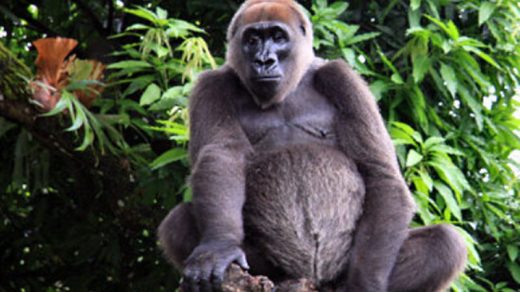
A census carried out by WWF and partners in 2014 showed populations of both western lowland gorillas and central chimpanzee living in the park. The IUCN considers the park a priority landscape for the conservation of western lowland gorilla and central chimpanzee.
A gorilla habituation process is currently taking place, to make it possible to use gorilla-focused eco-tourism to help fund the park and help local peoples find sources of income that do not threaten the park.
Examples of other primates living in the park are black colubus monkeys and mandrills. The park is also home to animals such as elephants, leopards, hippos, giant pangolin, duikers, bush pigs, and forest buffalo. Over 120 reptile species have been reported from within the park, as well as 165 fish species and 300+ species of bird.
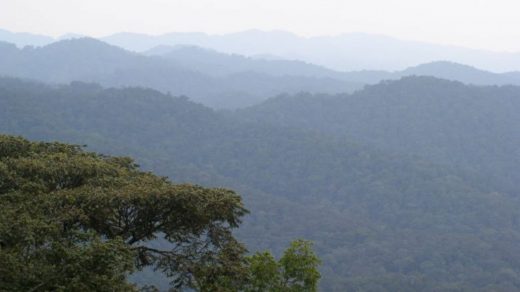
The dominating forest type in the park is closed evergreen canopy, with many members of the Caesalpiniaceae family. The forest region within which we find this park is believed to have persisted as a tropical forest region throughout the Pleistocene area, even when many other areas were going through cold periods.
29 species of plant are believed to be endemic to the park, as they have not been found anywhere else. The total number of plant species reported from the park is 256, including 22 that are listed as Endangered by the IUCN.
The list of serious threats to the park include logging, poaching, agriculture, and coastal development.
How big is Campo Ma’an National Park?
The park is 2,680 square kilometres.
The total area of the park + buffer zone measure approximately 700,000 hectares.
Natural resource extraction is prohibited throughout 4,196 sq km of the region.
Where is Campo Ma’an National Park?
Coordinates: 2°21′N 9°59′E
The park is located in Cameroon; in the South Region in the Océan division. The park borders with Equatorial Guinea to the south, and to the Atlantic Ocean to the west. East of the park, we find Vallée-du-Ntem and Mvila.
The national park is surrounded by buffer areas, five forest management units, and industrial plantations for rubber and oil palm.
Climate
November to March is dry season, followed by a dry period in April to June. July and August gets a lot of rain, but at some point in August the next dry season starts, which lasts throughout October.
Flora & Fauna
History
This park has its origins in an agreement formed between the Government of Cameroon and the Campo Forest Company in 1932, to create a wildlife reserve covering 1,582 square kilometres.
In 1980, the 990 square kilometre large Ma´an forest plantation next to the reserve was set up for conservation of the tree species Aucoumea klaineana.
In 1999, the forest was upgraded to a Technical Operational Unit (TOU) of 771,000 ha, and with a land allocation plan comprising protected area and protected forest, forest management units, a state maritime estate, and an agroforestry area.
In 2000, the protected area and protected forest was turned into the Campo Ma´an National Park, in compensation for environmental damage expected from the Chad-Cameroon pipeline.
Launched in 2000, The Campo Ma’an GEF/Biodiversity Project has provided additional funding for the park, to better protect it from the illegal retrieval of natural resources. Prior to this, there were no rangers present to enforce the protective rules. Since then, there have been clashes between park staff and poachers. Among other things, park staff has burned a hunting camp, and destroyed a boat used to access the protected area. Between 2011 and 2014, poaching decreased by 50%.
According to the WWF, a formal co-management agreement have been signed with the local Bagyeli peoples, which among other things includes employing local Bagyelis as guides and trackers for great ape conservation projects in the park.